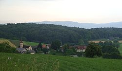
Dolenje Radulje
| Dolenje Radulje | |
|---|---|
| | |
| Coordinates: 45°56′5.95″N 15°20′6.08″E / 45.9349861°N 15.3350222°ECoordinates: 45°56′5.95″N 15°20′6.08″E / 45.9349861°N 15.3350222°E | |
| Country | |
| Traditional region | Lower Carniola |
| Statistical region | Southeast Slovenia |
| Municipality | Škocjan |
| Area | |
| - Total | 2.24 km (0.9 sq mi) |
| Elevation | 191.4 m (628 ft) |
| Population (2002) | |
| - Total | 79 |
Dolenje Radulje is a village in the Škocjan municipality in southeastern Slovenia. The area is part of the historical region of Lower Carniola. The municipality is now included in the Southeast Slovenia statistical region.
The local church is dedicated to Saint Michael and belongs to the Bučka parish. It is first mentioned in written documents dating to 1526.
References
External links
Retrieved from : http://en.wikipedia.org/wiki/Dolenje_Radulje
